Rafting, canoeing, fishing, hunting: all these activities and more occur on and along the National Landscape Conservation System's 2,061 miles of Wild and Scenic Rivers.
"A wild river is free of impoundments, generally inaccessible except by trail, and has exceptionally clean waters. Scenic classifications apply to sections that are free of impoundments and have shorelines that are largely undeveloped but are accessible by roads. Recreational segments are accessible by road and may have some development along their shorelines.”
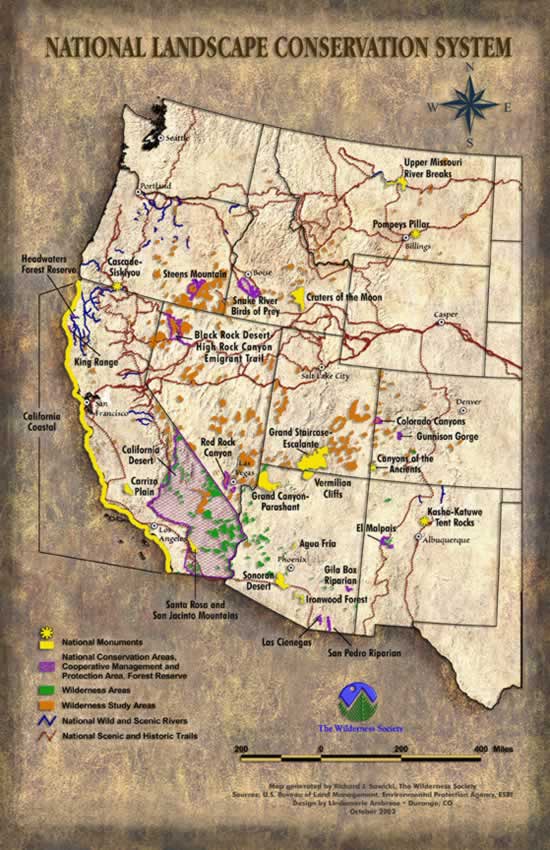
- BLM Alaska The Wild and Scenic Rivers Act of 1968 enables Congress or the Secretary of the Interior to designate a river, or a section of a river, as "wild, scenic, or recreational." The goal is to protect the river in its free-flowing condition, along with its scenic, recreational, geologic, wildlife, historic, and cultural values. The Bureau of Land Management manages about 20 percent of the nation's total Wild and Scenic River System. A sampling of those 36 rivers that run through the NLCS includes:
Unalakleet River
BLM manages the upper 81 miles of this clear, smooth river, which roams gently through the Nulato Hills, across the arctic tundra, to the seaside village of Unalakleet in northwest Alaska. The name Unalakleet is an Inupiaq Eskimo word meaning "place where the east wind blows." Moose, bears, bald eagles, wolves, fox, and beavers can be spotted along the river. The Unalakleet is best known for its king and silver salmon fishing opportunities. The Unalakeet River was a major trade route in the 19th century because it connected coastal Eskimos with Yukon River people, and Russian merchants.
North Fork American River
The "Giant Gap" run of this famous river is one of the most popular whitewater challenges in all of California. Cliffs rise 2,000 feet above the stream, lending beauty and majesty to a river that has attracted the attention of many artists including Thomas Moran and Lorenzo Latimer. In total this river is about 38.3 miles, all designated as "wild."
Klamath River
The Klamath runs through Northern California into Oregon and is California’s second largest river as well as being a major producer of salmon. The river includes 12 "wild" miles, 24 "scenic" miles, and 250 "recreational" miles in California, as well as 11 additional "scenic" miles in Oregon. Part of the river in Oregon flows through a pine and oak forested canyon en route to the Pacific Ocean. Part of the river contains a unique population of rainbow trout that are able to survive in unusually high temperatures; numerous endangered species also depend on the Klamath River for their survival, including bald and gold eagles, peregrine falcons, western pond- turtles, and Townsend’s big-eared bats. The river affords views of at least 40 prehistoric sites, including camp and burial grounds.
Missouri River
Lewis and & Clark utilized the Missouri River in Montana during their famous expedition to explore the western United States; some of the areas which served as their campsites still exist along the river. Forty-nine different species of fish reside in the Missouri River including a few 140 pound paddlefish. Some of the most common fish are goldeye, carp, and northern pike. The shoreline provides a home for soft-shelled turtles and beavers as well as a variety of waterfowl. A huge variety of species also live in the riparian zone of the river including 60 species of mammals and 233 species of birds.
Rio Chama
Flowing through a multi-colored sandstone canyon which in spots is 1,500 feet deep, the Rio Chama is a major tributary of the Rio Grande in northern New Mexico. Towering cliffs, densely wood canyons, sage plains, and gently rolling grass all are found along and near the river. Fishing is the most popular activity on the upper stretches, and the entire length offers relatively calm class II rapids for rafters. This roughly 25 mile river has 20 miles designated as "wild" and five as "scenic". The Rio Chama canyon also likely contains remains from the PaleoIndian, Archaic, and Prehistoric Pueblo time periods, though the area has yet to be thoroughly surveyed.
Deschutes River
The 173 mile long Deschutes begins high in the snow-capped Cascade Mountains of central Oregon and is characterized by deep rimrock-lined canyons that range from 900 to 2,600 feet deep. The upper portion of the river, with limited rapids, is primarily used for trout fishing. The middle portion offers excellent hiking opportunities with spectacular waterfalls, but limited boating access. The lowest segment is the best place for whitewater rafting and steelhead and trout fishing. Salmon and steelhead trout return to the lower end of the river each year to spawn and the upper region is one of the last strongholds of the bull trout. River otters and bald eagles also make their homes along the river.
John Day River (mainstem)
This 147.5 mile "recreational" river in central Oregon flows through a number of canyons and valleys and provides exceptional anadromous steelhead and warm-water bass fishing. The John Day is the second longest free-flowing stream in the continental United States, and one of only two river systems in the entire Columbia River Basin managed solely for wild anadromous fish. The John Day watershed also supports one of the largest remaining populations of wild Chinook salmon and steelhead in the Columbia Basin.
Owyhee River
The Owyhee flows from the Owyhee Reservoir in eastern Oregon to the Oregon/Idaho state border through mostly remote, arid, and undeveloped land. Much of the river travels through incised canyons that are home to mountain lions, bobcats, mule deer, golden eagles, and big horn sheep. The North Fork of the river, in the high plateau region of southeast Oregon, is provides for expert kayaking in an extremely remote environment.
Salmon River
This river is one of only a few designated for its entire length as "wild and scenic." The Salmon River begins in the snowfields of Mt. Hood and ends in the Sandy River, cascading in numerous waterfalls in the Salmon-Huckleberry Wilderness before reaching its lower forested canyons. Only an hour drive from Portland, Oregon the Salmon River is a popular for wild salmon and steelhead fishing. Other activities along the river include hiking, nordic and alpine skiing, and camping.
;)